
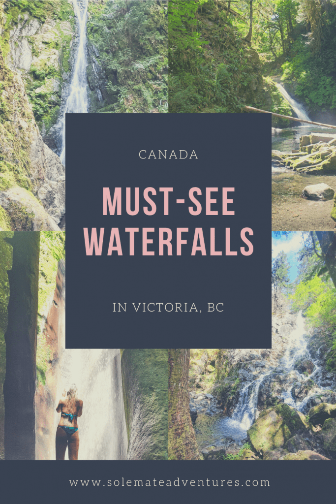
There’s something about waterfalls that just draws me in. I find them so relaxing and breathtaking at the same time. Luckily for us, Vancouver Island is full of amazing waterfalls and a number of them are not far from Victoria, where we live. With the exception of one, all of these waterfalls are within a 1 hour drive of Greater Victoria. Below are 11 of our favorite Victoria, BC waterfalls you can’t miss!
Must-See Victoria, BC Waterfalls
Victoria, BC Waterfalls Within 20 Kilometers
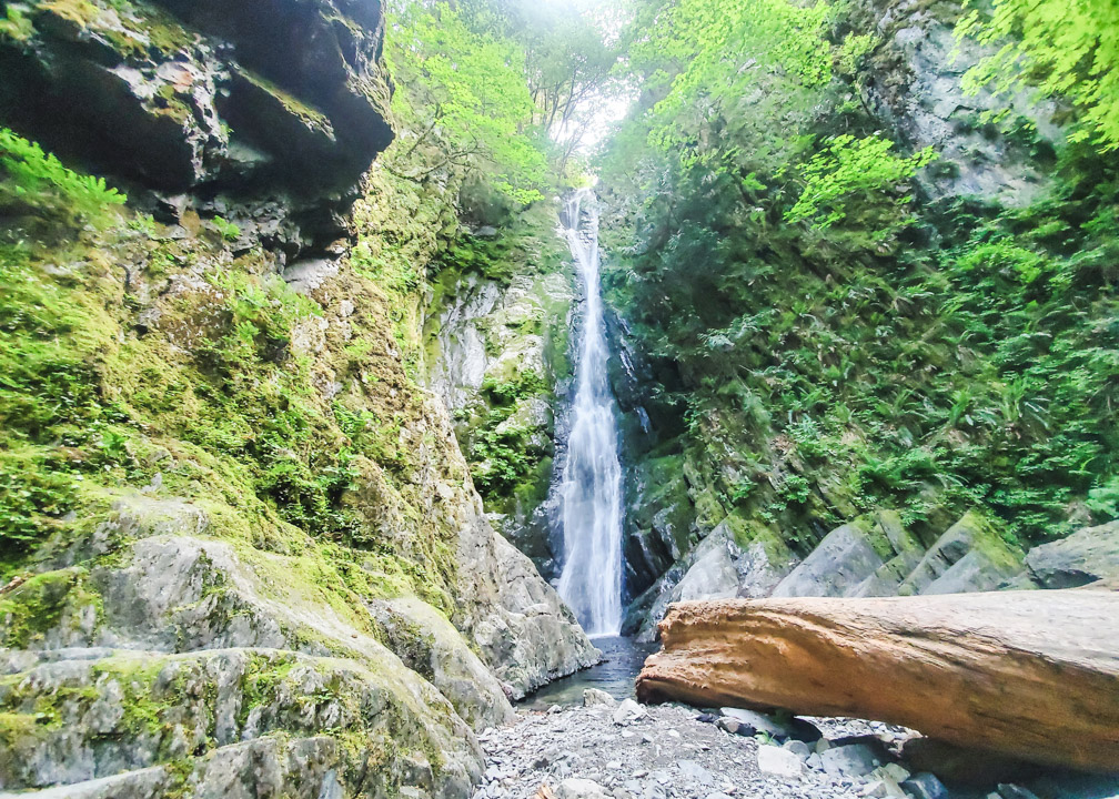
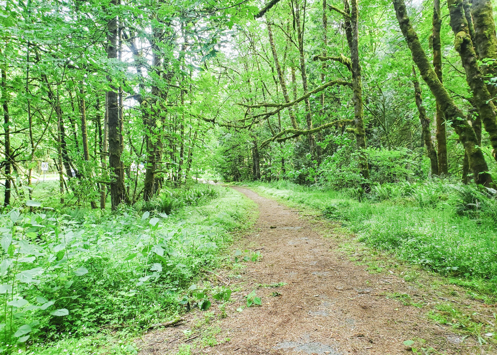
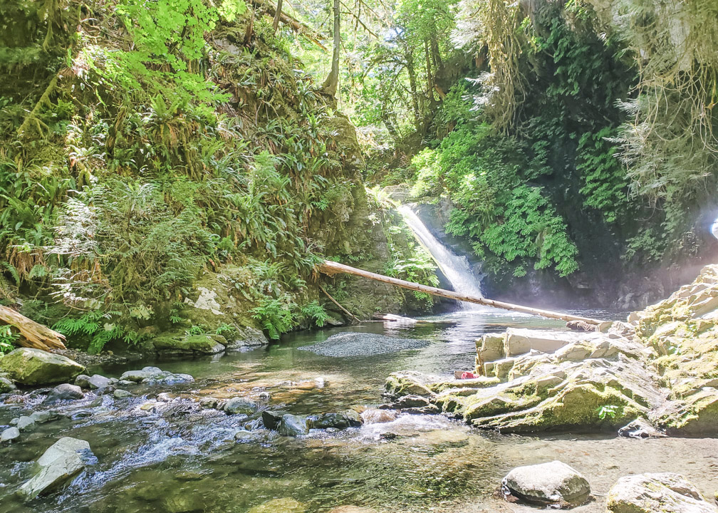
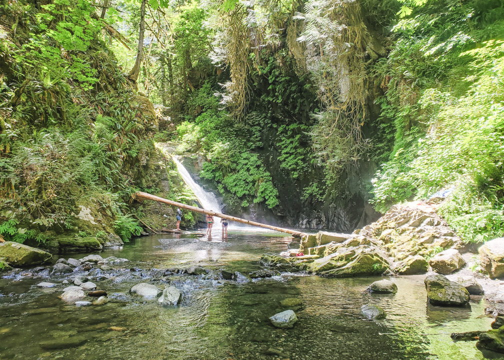
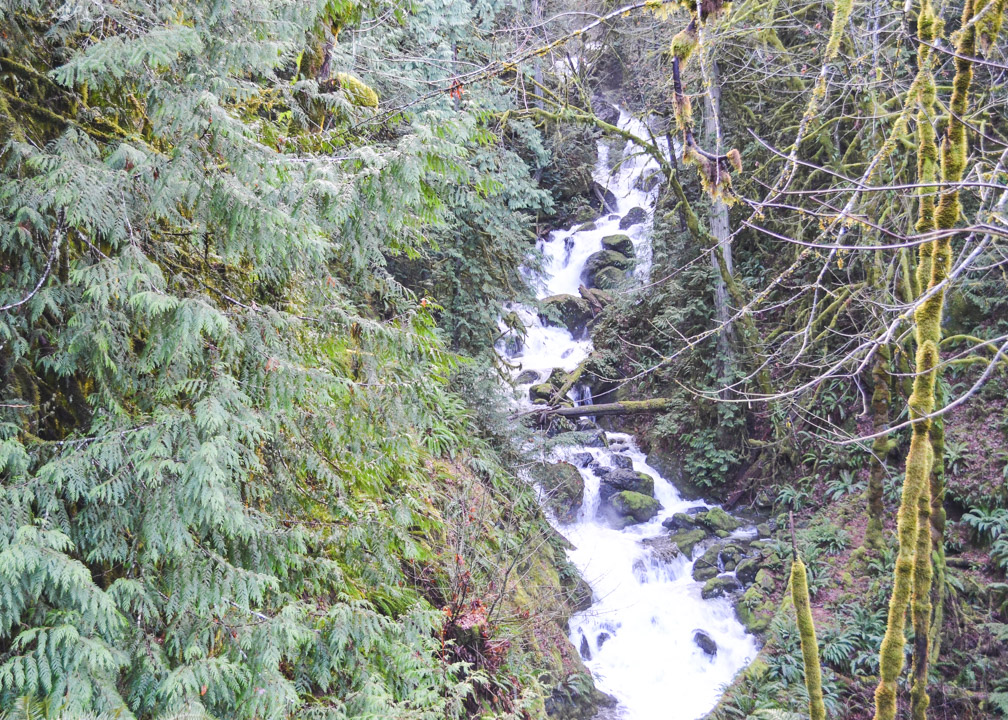
1. Little Niagara Falls
Distance from Victoria: 19km. About 25 minutes driving, depending on traffic.
Accessible by Public Transit: No
Hiking Required: Very little, less than 500m.
Difficulty Rating: Easy. There is some walking involved, but if you park on the southbound side of the highway, it is a short walk to the falls. However, there is a small set of stairs involved so it may not be easy for those with mobility issues.
How to get to Little Niagara Falls: Little Niagara Falls is located within Goldstream Provincial Park, just north of Victoria, at the start of the Malahat drive. The entrance is off of the Trans-Canada Highway (Hwy 1) so it is easy to find. The thing is, if you are coming from Victoria, the falls are on the left side of the highway, but the park entrance is on the right side.
If you are visiting during spring or summer, this isn’t too much of an issue, as there is a tunnel below the highway that you can take to get to the falls. However, it is not accessible during the wet months, as the river will be flowing through the tunnel.
You will need to continue driving north on the highway and watch for the U-Turn Route signs a few kilometers up. Make a safe U-turn, and then as you approach Goldstream Park, you will see a small parking lot on the side of the highway to your right.
From the parking lot, take a few steps up to where you’ll see the park board, then take the stairs down on your right. At the bottom of the stairs, you will see a path going to the left, alongside the river bed. Within 2 minutes you will see the beautiful Little Niagara Falls!
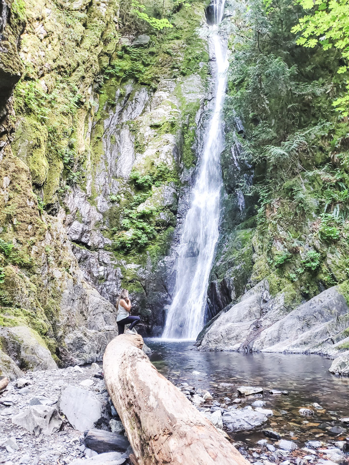
Little Niagara Falls Review: This is one of the closest and easiest waterfalls to get to, making it one of my favorite Victoria, BC waterfalls! I love making a quick stop here when we are driving back home from up island, or making a quick detour to the falls when hiking in the area. The falls are most impressive in the winter months, but they are still quite beautiful in the summer, too! I like that in the summer you can hike down into the river bed and get closer to the falls. If you don’t mind the cold water, you could even take a quick dip!
2. Hidden Spring Falls
Distance from Victoria: 19km. About 25 minutes driving, depending on traffic.
Accessible by Public Transit: No
Hiking Required: Yes, a little, less than 1km.
Difficulty Rating: Easy. The trail is a little overgrown but it is mostly flat and no slippery parts.
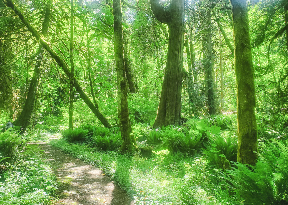
How to get to Hidden Spring Falls: Hidden Spring Falls is located within Goldstream Park as well. But as the name suggests, it is quite hidden, and in fact, I only just discovered these falls this year! When we went, we didn’t see anyone else around, so it’s a bit of a hidden gem.
To get to Hidden Springs from Victoria, turn off at Goldstream Park on your right, then turn around to get back on the highway, heading left, back in the direction of Victoria. You will see a small pullout area on the right of the highway, by a gate. It’s easy to miss, so make sure to check the map at the end of this post.
Park in the pullout area and then walk past the gate and down the overgrown pathway.
You will see a marked trail on your right, but this is NOT the trail to the falls. Just past this trail, you will see a smaller, unmarked trail that will likely look overgrown. This is the trail you want to take.
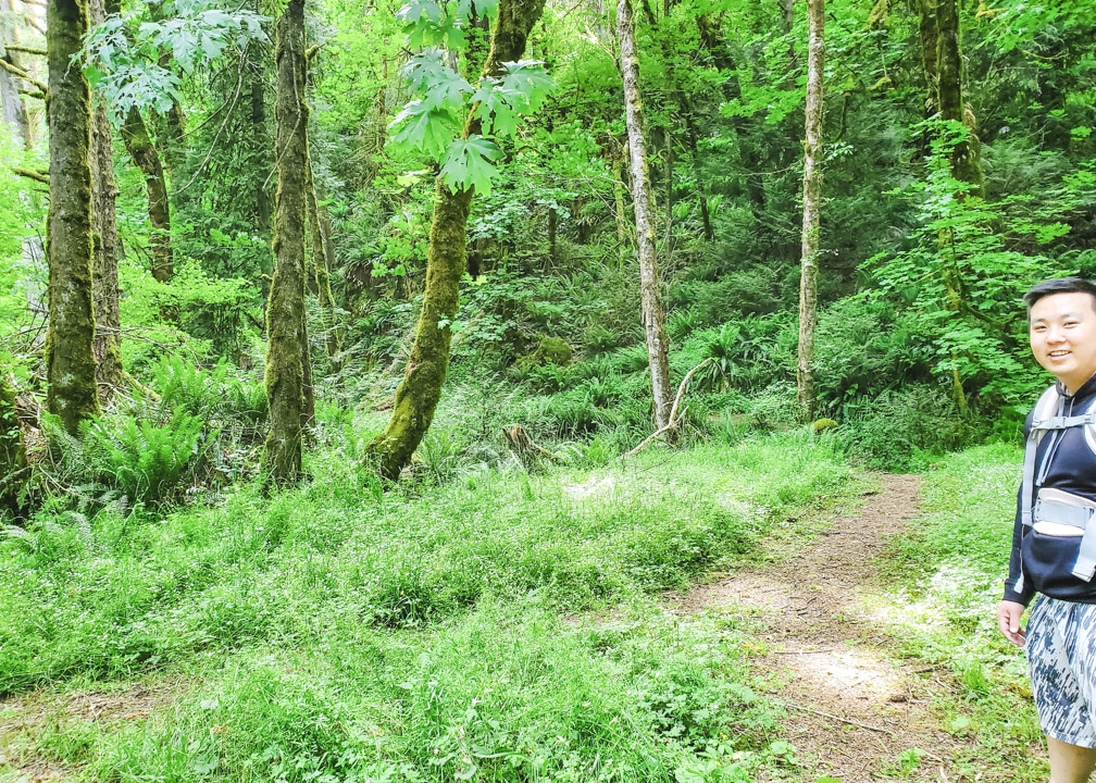
Follow this overgrown trail about 5 minutes and you will soon hear the water flowing, and reach Hidden Spring Falls 🙂
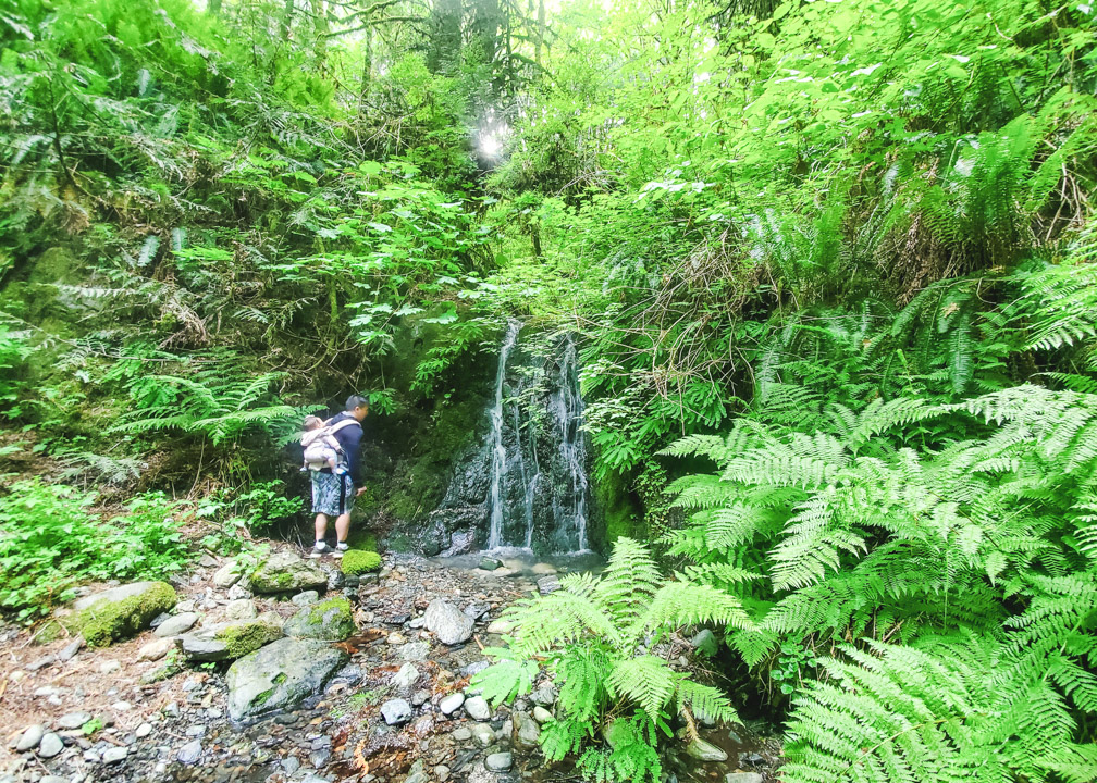
Hidden Spring Falls Review: These falls are quite small, but I enjoy them because they are not well-known and still pretty hidden. It’s such a refreshing spot to relax, especially after hiking around the area.
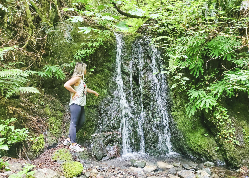
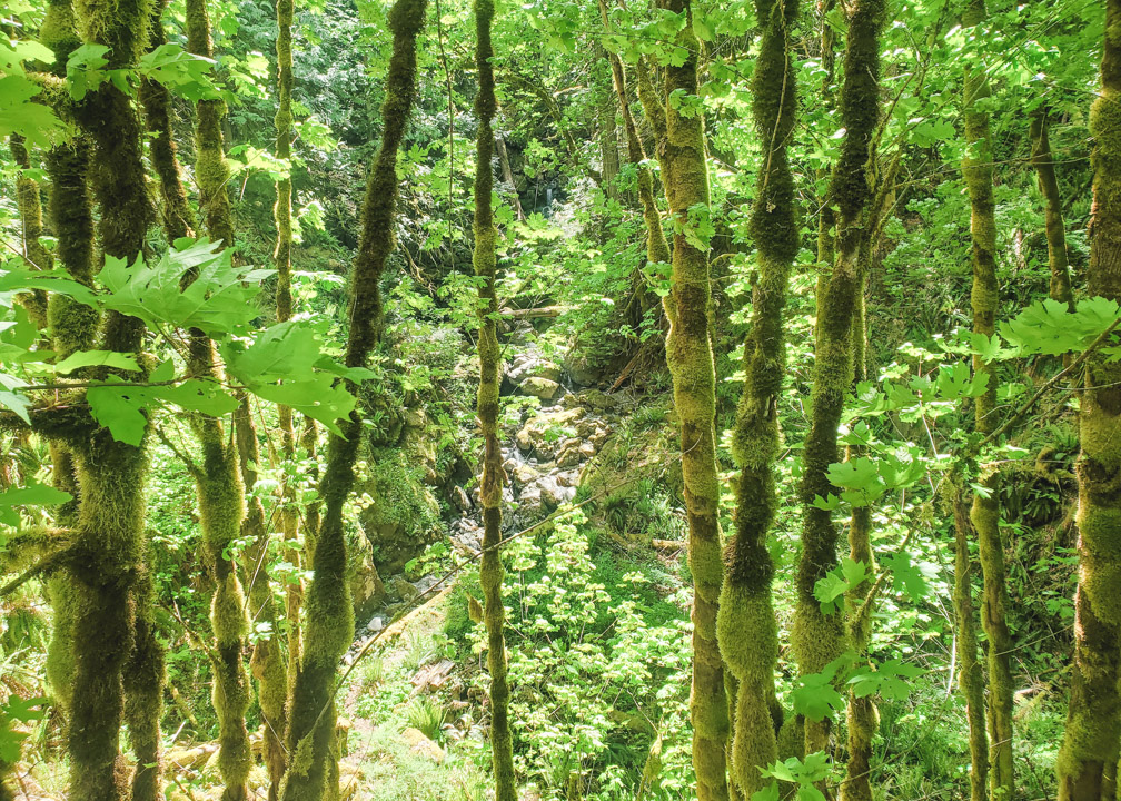
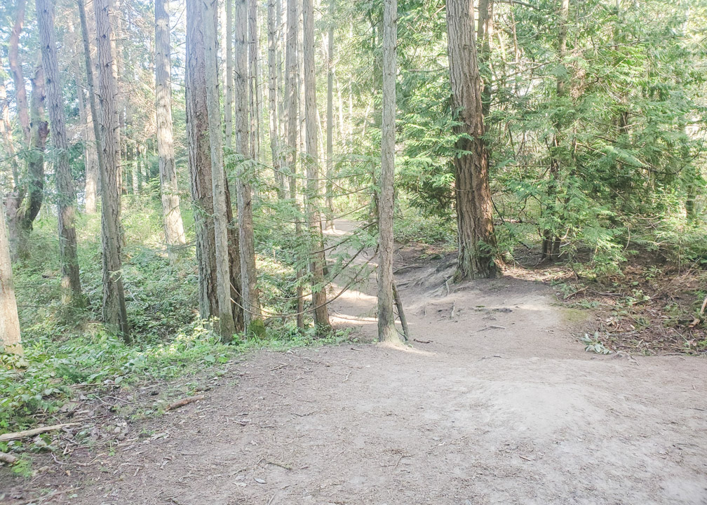
3. Bridge Trail Falls
Distance from Victoria: 19km. About 25 minutes driving, depending on traffic.
Accessible by Public Transit: No
Hiking Required: No
Difficulty Rating: Very Easy
How to get to Bridge Trail Falls: This is another little hidden gem, again in Goldstream Park!
Coming from Victoria, you will turn off at Goldstream Park and park in the parking lot there. Walk along Finlayson Arm Road, past the bridge, and very soon after, you will see a small trail to your right.
Bridge Trail Falls Review: This is a very easy, quick walk from the parking lot, perfect for walking the dog, going for a stroll with the kids or even older family members.
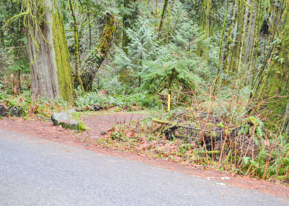
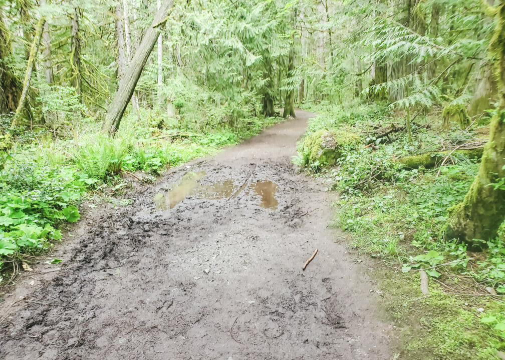
However, the falls are dried up in spring/summer, as shown in the photo below, so keep that in mind when planning your visit!
It is a much more impressive sight in the winter.
If you want to tick 3 Victoria, BC waterfalls off your list, then an afternoon at Goldstream Park is the perfect way to do it!
4. Goldstream Falls
Distance from Victoria: 18km. About 30 minutes driving, depending on traffic.
Accessible by Public Transit: Yes. Both the 47 and 58 buses stop very close by, at Ma Miller’s Pub.
Hiking Required: Yes, about 3km roundtrip.
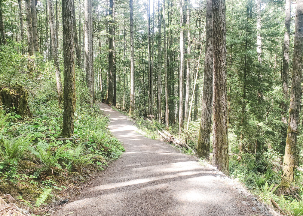
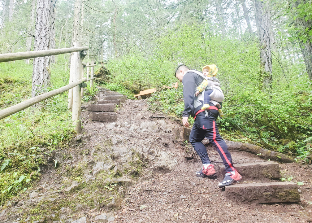
Difficulty Rating: Easy-Moderate. There are two trail options: Upper Goldstream Trail, which is quite muddy in parts and does have some slight uphill and downhill sections with rocks and roots, or you can walk through the campground. If you are of average fitness, the Upper Goldstream Trail should be fairly easy for you, but I would not suggest it for older family members or anyone with mobility issues. Either way you take, you will have to descend a few flights of steep stairs at the end.
How to get to Goldstream Falls: As the name suggests, Goldstream Falls is also located in Goldstream Provincial Park, but within the campground area. It is possible to hike there from the day use area, but it’s about a 10km hike round trip along the Gold Mine Trail.
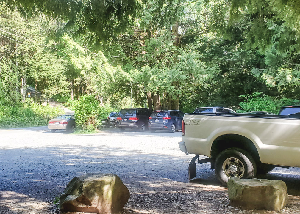
The easiest way is to access it from within Goldstream Campground, where you can walk along the road and then take the stairs all the way down to the falls. To get to the campground, head north on Highway 1 and then turn left at Westshore Parkway, where you’ll see the Shell gas station and Tim Hortons. At the first roundabout, turn right onto Amy Road and continue for about a kilometer. At the end of the road, turn left onto Sooke Lake Road. After less than a minute, you will see Ma Miller’s Pub on your left, and the entrance to Goldstream Campground on your right.
If you are not camping there, it’s no problem. You can drive in and find parking on the side of the road before the campground area. If there’s no parking available, you will have to park in the lot outside the outer gate, by the pub, and walk in from there.
Once you park, walk into the campground, past the gatehouse, and to your left you will see the trailhead for Upper Goldstream Trail. This trail follows the Goldstream River and leads you to the falls.
The final leg of the trail is down a few sets of steep, metal stairs, which can be quite tiring and difficult going up for some people.
An alternative to the Upper Goldstream Trail is to walk through the campground instead. Either way, you won’t be able to avoid the metal stairs, though.
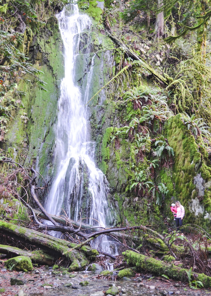
Goldstream Falls Review: I really love these falls. They are fairly easy to get to and when the weather is nice, this is one of the few Victoria, BC waterfalls you can swim under!
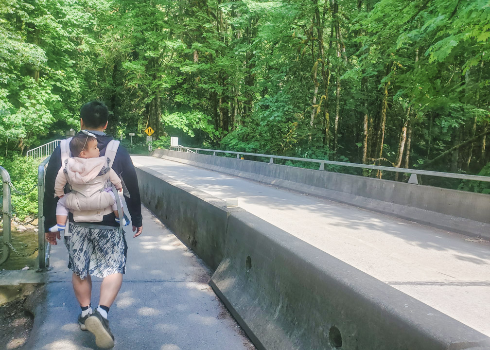
5. Waugh Creek Falls
Distance from Victoria: 19km. About 30 minutes driving, depending on traffic.
Accessible by Public Transit: Partly. The 58 will take you close, but you’ll have to walk another 1.6km from the bus stop.
Hiking Required: Yes, about 5km roundtrip.
Difficulty Rating: Easy. The trail is very well-maintained and is also used as a bike trail. There are some small slopes, but it is pretty flat for the majority, with no rocky, slippery, nor muddy sections, even in winter.
How to get to Waugh Creek Falls: These falls are located very close to Goldstream Falls, but you access it from Sooke Hills Wildnerness Regional Park in Langford, in the Westhills area. When going north on Highway 1, turn left at Westshore Parkway (where the Shell and Tim Hortons are).
Continue on Westshore Parkway for about 2km, going straight at each of the 3 roundabouts. Immediately after the 3rd roundabout, turn right onto Meridian Ave. After 2 blocks, turn left onto Irwin Rd and continue for about 1km.
You will see a parking lot on your right and another one where it says Mount Wells Regional Park. You can park in either. From the parking lot, go towards your right and you will see the big information board and map for the Sooke Hills Wilderness Park.
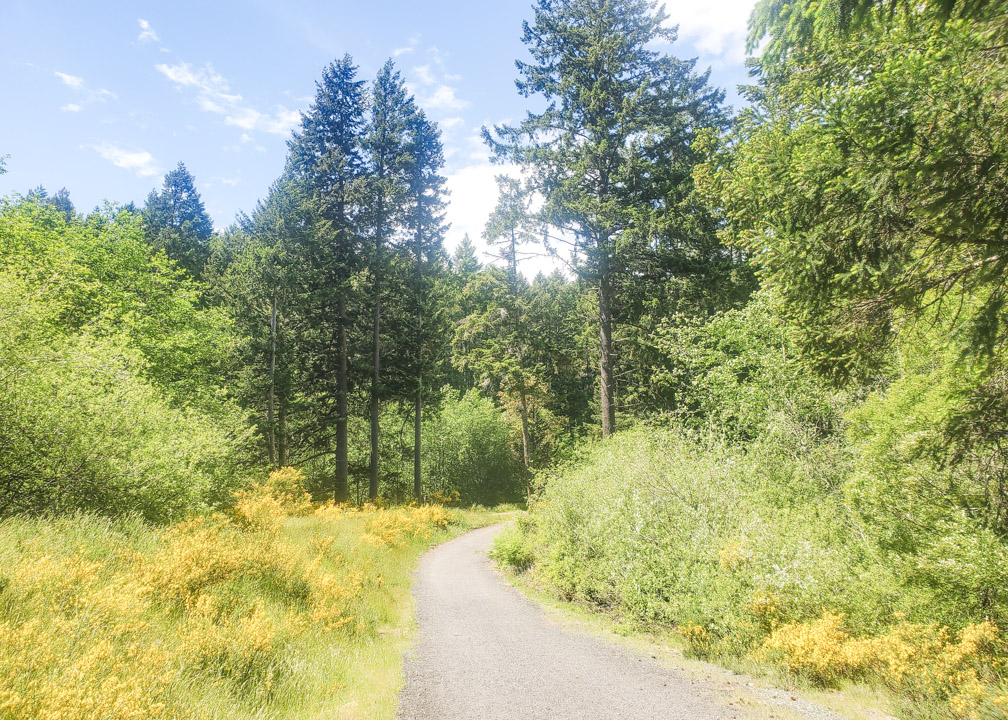
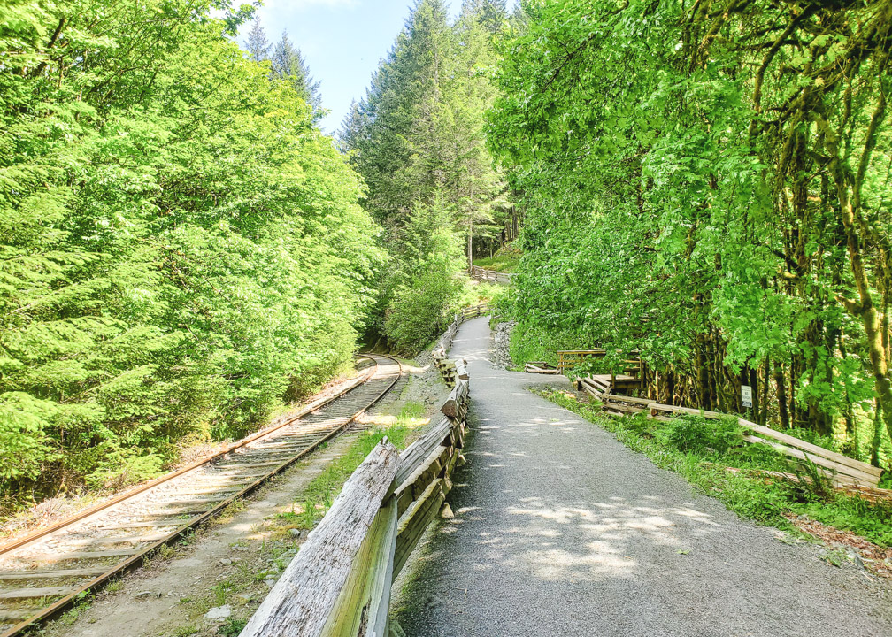
From the information board, continue down the well-maintained trail for about 2.5km. You will see train tracks on your right and a viewing platform to your left. Through the trees, you will see Waugh Creek Falls!
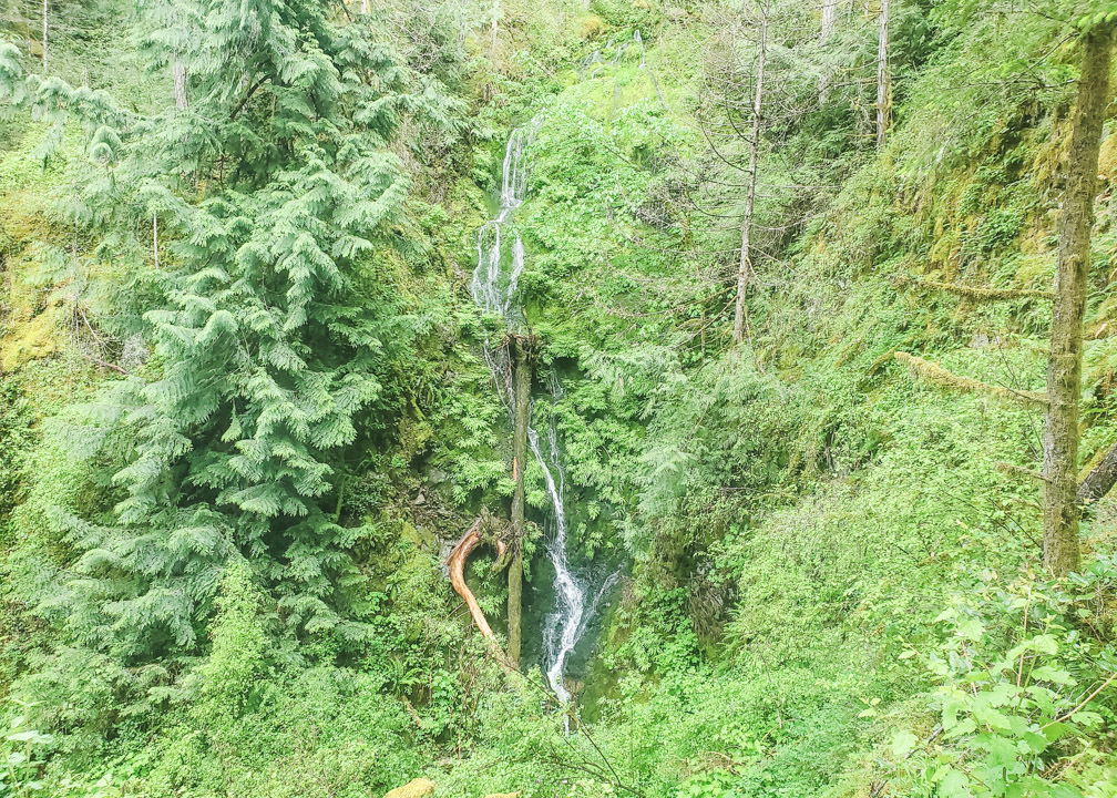
Waugh Creek Falls Review: The falls are much more impressive during the winter months, as during spring/summer, the falls are reduced to just a trickle, as seen in the photo below.
These falls are definitely more beautiful in person than they come off in photos. Considering how nicely maintained the trail is, this is a great walk for almost any ability level with hardly any elevation change. It’s even stroller-friendly if you have a jogging stroller 🙂
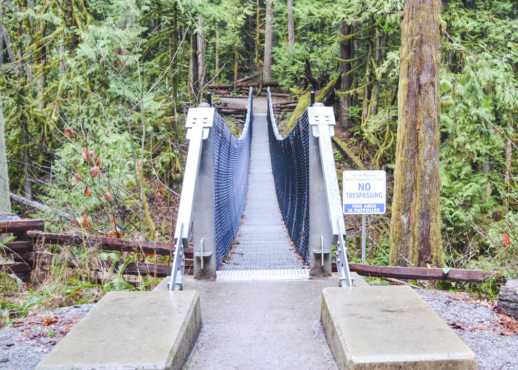
Also, if you continue on a little past the falls, there is a nice little suspension bridge over the Goldstream River!
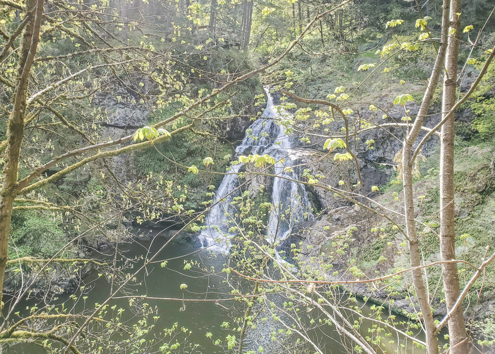
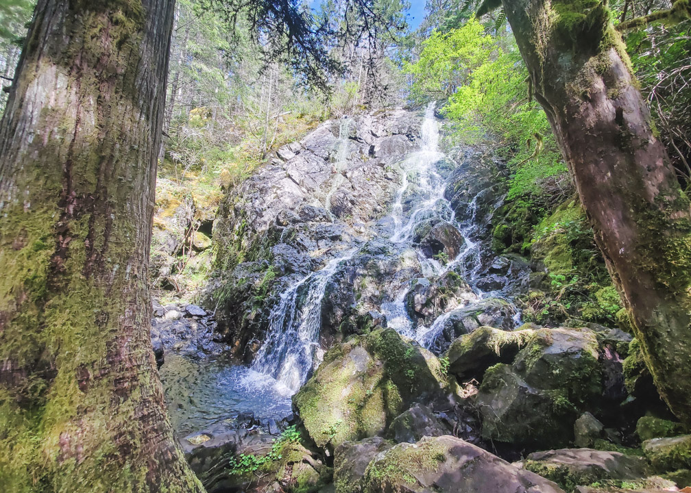
6. Cascade Falls
Distance from Victoria: 20km. About 25-30 minutes driving.
Accessible by Public Transit: No
Hiking Required: Yes, about 3.5 km round trip.
Difficulty Rating: Moderate. The trail has some muddy and slippery sections, and the section by the falls is quite steep.
How to get to Cascade Falls: These falls are located not far from the famous Butchart Gardens, within the beautiful Gowlland Tod Provincial Park. Coming from Victoria, take the BC-17 Highway (known locally as the Pat Bay Highway) and head north, towards Sidney. There are a couple different ways to get to Gowlland Tod from the Pat Bay Highway, but usually the quickest way is to take Exit 11 to Royal Oak (you’ll see Thrifty’s on your right).
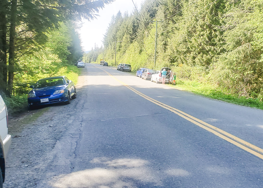
After you exit, turn left onto Royal Oak Dr, and then shortly after, turn right onto West Saanich Road (BC-17A). Continue on W Saanich Rd for almost 6km and then turn left onto Wallace Dr. Then take your second left onto Willis Point Rd. Follow this road for about 4km and then turn left onto Ross Durrance Rd. You will see a parking lot on your left for Mount Work Regional Park. This is the best place to park, but if it is full, look for parking on the road. Make sure your tires are off the pavement, though, otherwise you could get towed.
Across from the parking lot, you will see the trailhead for McKenzie Bight. Continue further left down the road and you will see the Timberman Trail head. Take the Timberman Trail and about 1km in, you will connect to the Cascade Trail on your right, which will bring you down to the falls.
Cascade Falls Review: These falls are most beautiful in the winter, but are still quite pretty and enjoyable in the spring.
I love the hike as well, as it is not too long nor strenuous, but still good exercise. If you want more of a workout, consider taking the McKenzie Bight Trail down to the ocean, and then take the Cascade Trail up to the falls instead. The steep incline will get your heart pumping 🙂
We chose to continue down to the inlet after the falls, which made for a lovely and relaxing afternoon. Afterwards, we walked back up via the McKenzie Bight trail which was a little less steep.
7. Sitting Lady Falls
Distance from Victoria: 20km. About 30-35 minutes driving, depending on traffic.
Accessible by Public Transit: Yes. Take the 50 to Langford, then transfer to the 54 to Metchosin.
Hiking Required: A little.
Difficulty Rating: Easy. The trail is well-maintained and it’s only about a 200m walk down to the falls. However, the falls are best viewed from the opposite side, which requires walking further down the Lagoon Trail about another 300m. There is a bit of incline on the way up, so it may not be recommended for those with mobility issues, but is easy for those of average fitness.
How to get to Sitting Lady Falls: This lovely waterfall is located in Metchosin within Witty’s Lagoon Regional Park. From downtown Victoria, head north on Highway 1 towards Colwood. Take Exit 10 towards View Royal/Colwood. Continue down the Old Island Highway/Sooke Road for about 5km. Then turn left onto Metchosin Road. Continue on Metchosin Road for about 7km and on your left will be the parking lot for Witty’s Lagoon.
Take the trail down past the Nature House and within a few minutes you will reach the bridge. If you cross the bridge, you will see a viewing platform which sits right above the falls. However, the view is better from the other side, so instead of crossing the bridge here, take the trail to your left, which is the lagoon trail. Continue walking down for about 5 minutes, and on your right, you will find another viewing platform with a spectacular view of Sitting Lady Falls 🙂
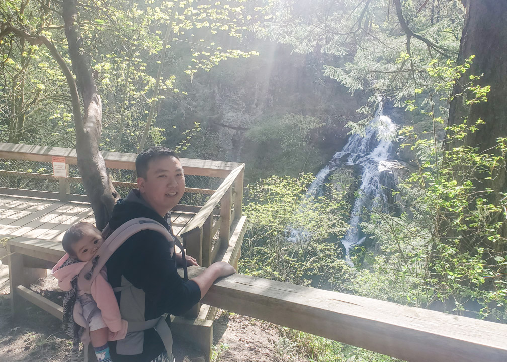
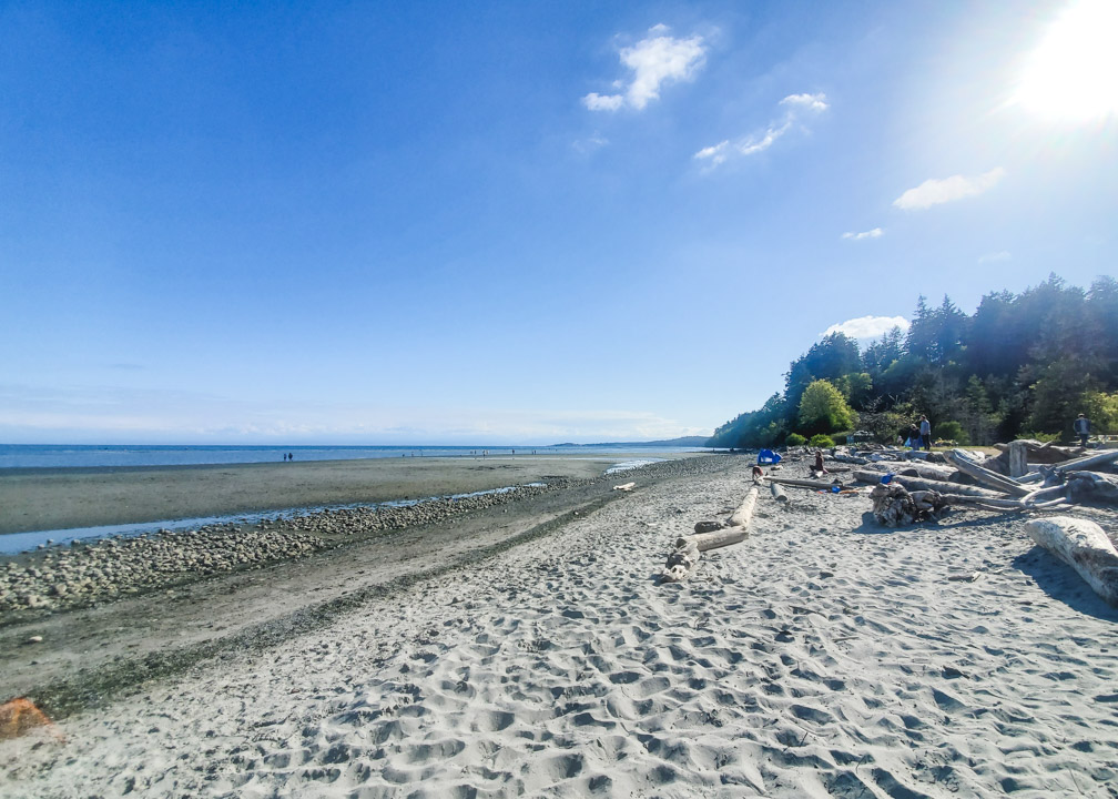
Sitting Lady Falls Review: This is a great, quick walk to a lovely waterfall that I find is highly underrated! It’s great for kids, especially since you can continue down to Witty’s Beach, a favorite in the Victoria area for it’s sandy beach and calm waters.
Victoria, BC Waterfalls Within 50 Kilometers
8. Mary Vine Creek Waterfall
Distance from Victoria: 40km. About 50-60 minutes driving.
Accessible by Public Transit: No
Hiking Required: Yes
Difficulty Rating: Easy. The hike is less than 2km round trip, with little incline, but a bit rocky and muddy in parts. Wouldn’t recommend for those with mobility issues, but it’s a good one to do with kids and anyone of average fitness level.
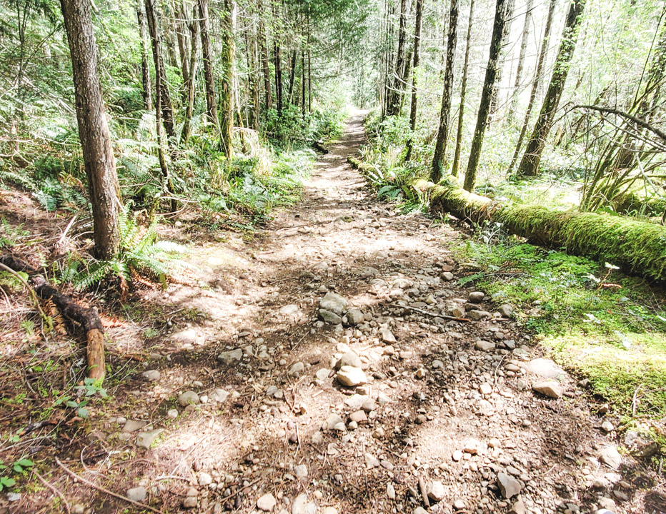
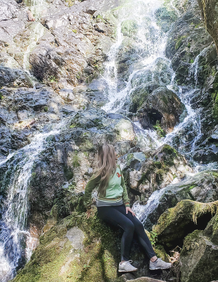
How to get to Mary Vine Creek Waterfall: Another one of my favorite Victoria, BC waterfalls and hidden gems, Mary Vine Creek Waterfall is located within the Sooke Potholes Regional Park. This one is a bit further out from Victoria, but there is a lot to see in the area, so it is well worth the drive in my opinion.
Read Road Trip Along Vancouver Island’s Beautiful West Coast for more to see at Sooke Potholes!
From Victoria, head north on the Trans-Canada Highway. Right before the start of the Malahat drive, turn left at Westshore Parkway. Continue on Westshore Parkway for about 4km, then turn right onto Sooke Road/BC-14 West. Continue down this winding highway for about 16km until you reach Sooke River Road. You’ll see signs for Sooke Potholes. Turn right and follow this road for about 10 minutes until you reach Sooke Potholes.
Once you enter the park, don’t park in the first parking lots you see. Continue on a few minutes until you reach Parking Lot 2 and park there. Don’t forget to pay for parking. At the back of the parking lot, you will find the entrance to some trails. The big one is the Galloping Goose – don’t turn onto this trail. The trail you want to take is the smaller one, straight ahead of you, the Peden Lake Trail. Less than a kilometer in, about 700m, you will see a sign pointing to the falls on your left.
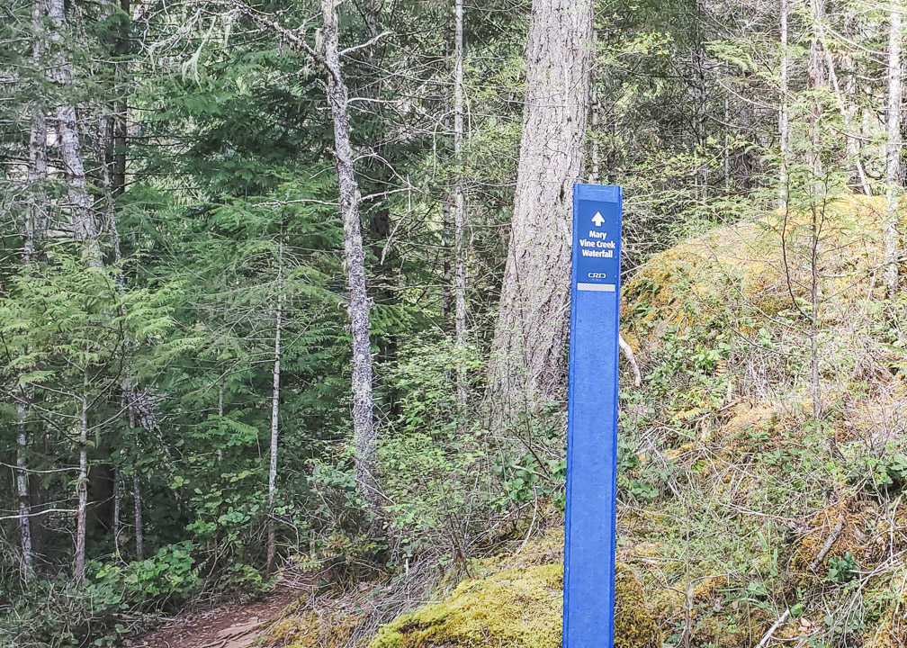
Mary Vine Creek Waterfall Review: This is one of my favorite hidden waterfalls in Victoria, BC. It doesn’t seem to be that well-known, yet it is quite beautiful! I love how close you can get to the falls. Such a nice treat for a short hike, or as part of a longer one up to the lake.
Victoria, BC Waterfalls Within 75 Kilometers
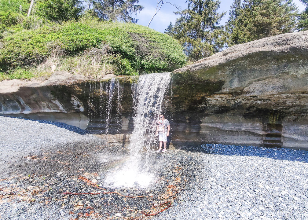
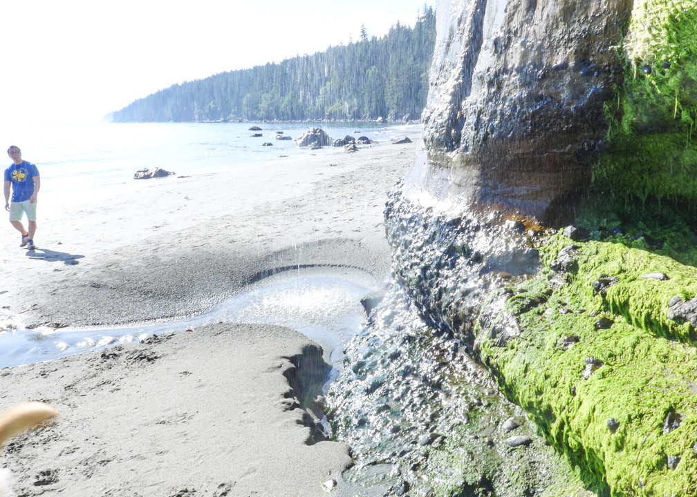
9. Sandcut Beach Waterfalls
Distance from Victoria: 67km, about 1 hour and 15 minutes driving.
Accessible by Public Transit: No
Hiking Required: Yes
Difficulty Rating: Easy
How to get to Sandcut Beach Waterfalls: Sandcut Beach is located past Sooke, by Jordan River. From Victoria, take the Trans-Canada Highway north to Langford, then take exit 14 on your right, towards Sooke. From the exit, it’s about 3km until you reach Sooke Road, where you will want to turn right. Sooke Road turns into the Juan de Fuca highway, which you will continue on for about 50km.
Eventually you will come across Sandcut Beach on your left, within Jordan River Regional Park. The parking lot for Sandcut Beach is quite small so you’ll likely see a ton of cars parked on either side of the road.
Make sure if you park on the road that your tires are not touching the pavement otherwise you can be towed.
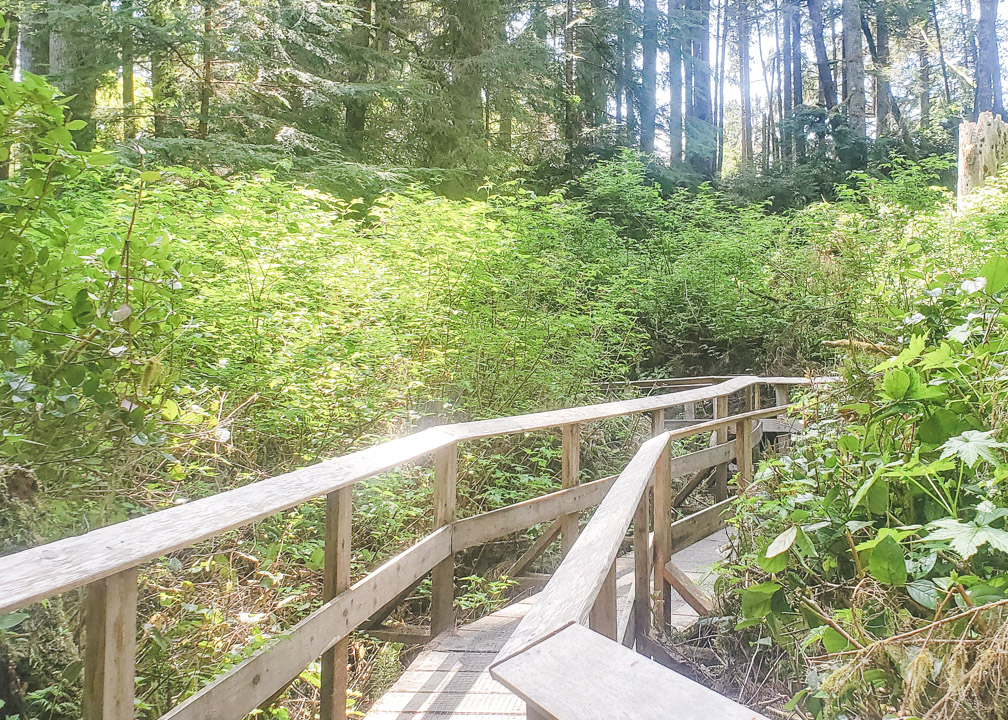
From the parking lot, follow the Sandcut Beach Trail and you will reach the beach in about 15 minutes. The trail is pretty well maintained and it’s a nice walk through the forest, including some boardwalks, and a final staircase down to the beach.
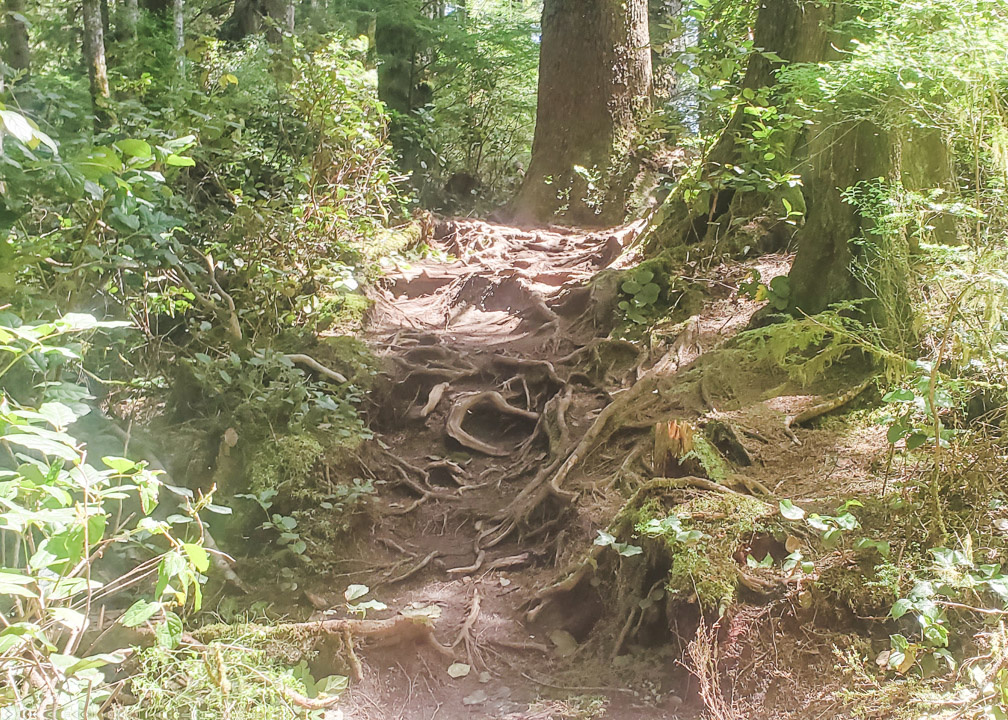
It’s an easy walk down for those of average fitness, but due to its length and some rooted areas, it may not be recommended for those with mobility issues.
Once you arrive at the beach, head to your left and about 5 to 10 minutes down, you will see the waterfalls flowing onto the beach 🙂
Sandcut Beach Falls Review: I love these unique falls that flow onto the beach. It is quite fun for kids (and adults!) to run and play beneath the falls.
As usual, these falls are much more impressive in the winter months, but they are still pretty in the spring. And after viewing the falls, you can enjoy the rest of stunning Sandcut Beach! It’s a great, family-friendly spot, especially for young rock collectors 🙂
Also, FYI – there are bathrooms available by the parking lot, but not at the beach, so make sure to use them before you head down.
10. Mystic Beach Waterfall
Distance from Victoria: 75km, about 1.5 hours driving.
Accessible by Public Transit: No
Hiking Required: Yes
Difficulty Rating: Easy-Moderate
How to get to Mystic Beach Waterfall: Mystic Beach is located just past Sandcut Beach and Jordan River. From Victoria, take the Trans-Canada Highway north to Langford, then take exit 14 towards Sooke. About 3km from the exit, turn right onto Sooke Road which then turns into Highway 14/Juan de Fuca Highway. Follow the highway for almost 60km until you see signs for China Beach and park there.
From the parking lot, check the sign board and take the Juan de Fuca Trail, NOT the China Beach Trail. From here, it is about 2km to Mystic Beach. The trail is well-worn and can be muddy in parts, along with roots and logs. There is not much elevation change, though, so I would still consider it easy enough for those of average fitness. The trail meanders through the lush, quiet forest, complete with a fun suspension bridge to cross and some staircases. As you approach the beach, you will begin to hear the crashing of the waves and know you are getting close.
Once you reach the beach, walk down the beach to your left and you will come to the waterfall falling down onto the beach.
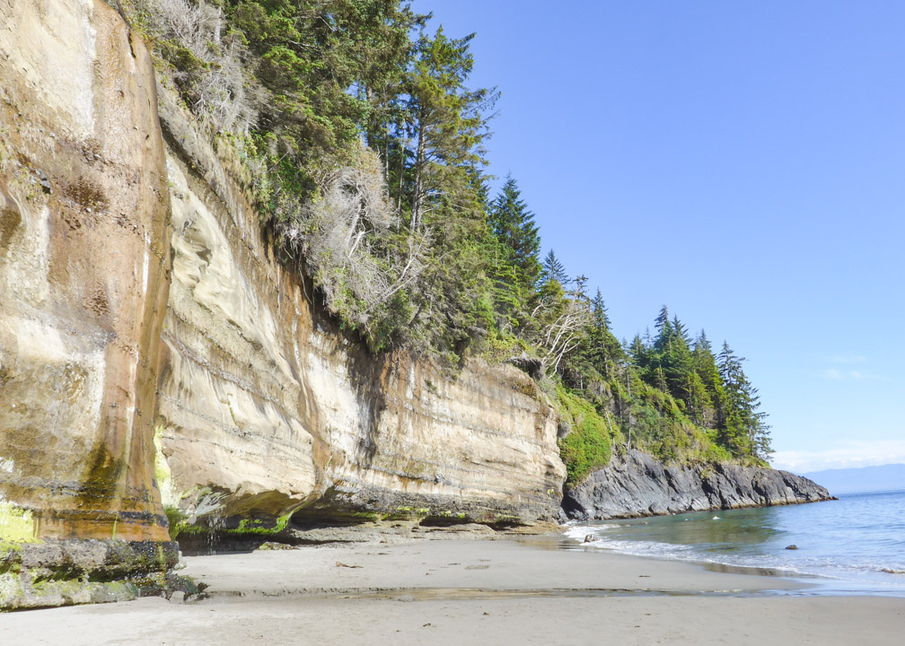
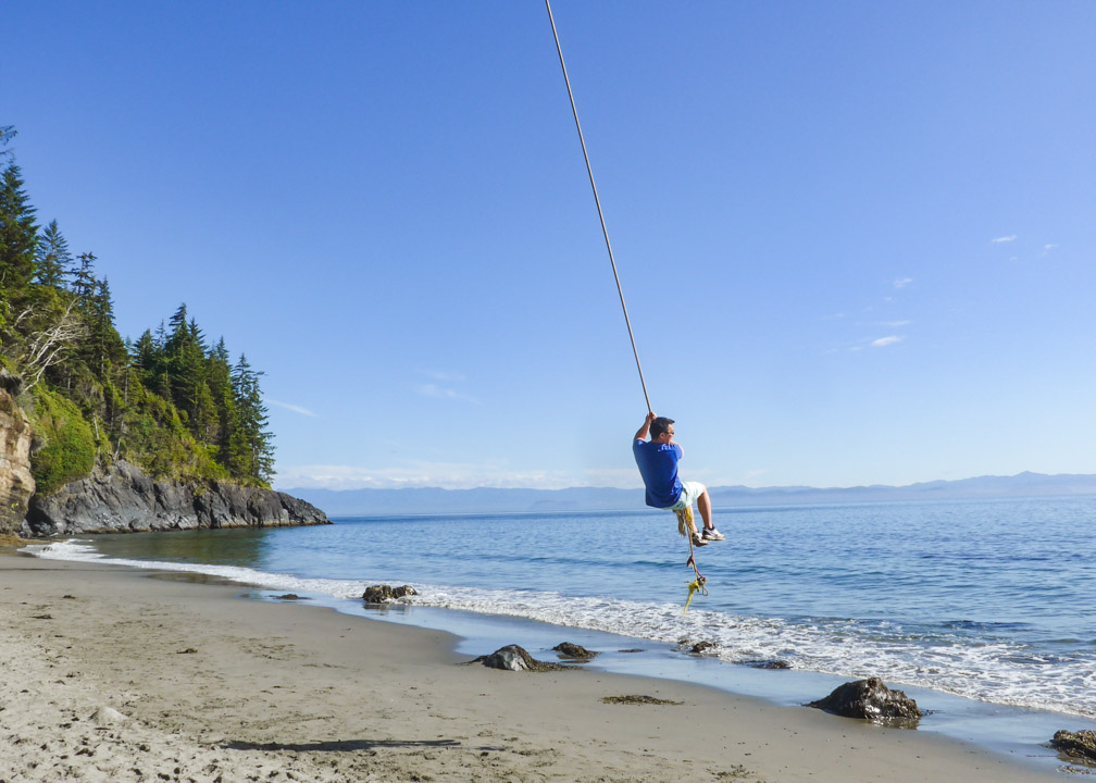
Mystic Beach Waterfall Review: Mystic Beach is a great day trip to get in a little hiking, waterfall viewing, and beach time! As with most other Victoria, BC waterfalls, Mystic Beach waterfall is more impressive in the winter months, as it is reduced to more of a trickle in the summer.
It is still pretty, though, and the beach is absolutely gorgeous. There is an awesome rope swing right on the beach that you can enjoy, too!
Victoria, BC Waterfalls Within 100 Kilometers
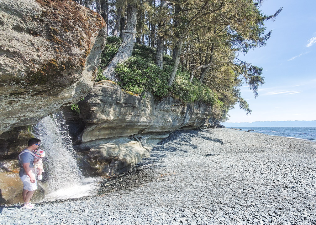
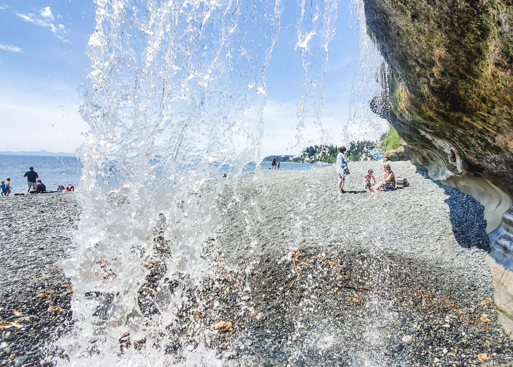
11. Sombrio Beach Hidden Waterfall
Distance from Victoria: 96km, about 1 hour and 45 minutes driving.
Accessible by Public Transit: No
Hiking Required: No
Difficulty Rating: Easy
How to get to Sombrio Beach Hidden Waterfall: This is the furthest waterfall on our Victoria, BC waterfalls list, but it is well-worth the drive! From Victoria, take the Trans-Canada Highway north to Langford, then take exit 14 towards Sooke. After about 3km from the exit, turn right onto Sooke Road which turns into Highway 14/Juan de Fuca Highway. Follow Highway 14 for about 78km, past Sooke and Jordan River, til you almost reach Port Renfrew.
From Highway 14, you will see a small road on your left with signs for Sombrio Beach. This bumpy, rugged gravel road will take you to the parking lot, which gets quite packed in the summer. Note that this road is quite rough so make sure your vehicle can handle it. From the parking lot, it is an easy walk down to the beach. When you reach the fork, take the trail to the left. Once you reach the beach, it is another 15 minutes or so walk to your left to find the entrance to the hidden waterfall.
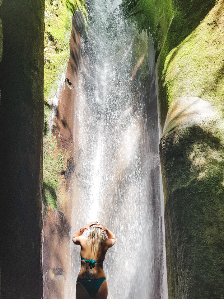
A lot of people easily miss this stunning hidden waterfall as you can’t see it from the beach. After walking for about 15 minutes, look for a small stream flowing out onto the beach, as shown below. This is your clue to find the waterfall!
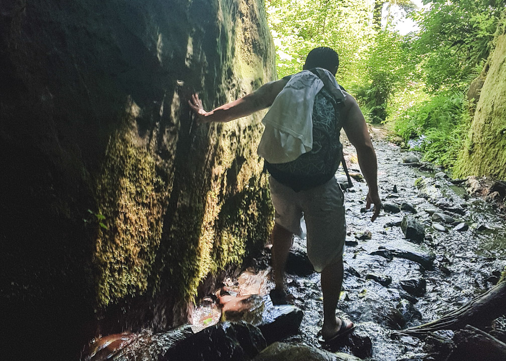
Follow this tiny stream to enter what looks like a cave, and climb along the rocks upstream between the cliff walls. Be careful as it can be quite slippery!
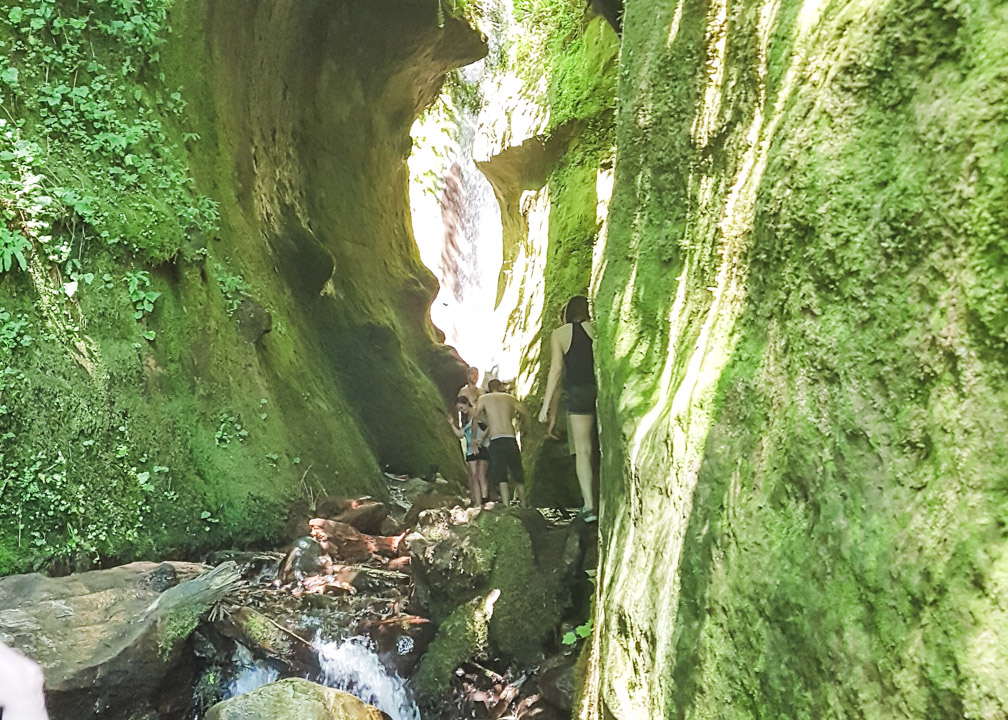
We did this in flip flops which was good in a way because your feet get wet, but it was difficult and slippery in parts. We ended up just taking off our flip flops halfway and going barefoot the rest of the way as we found it less slippery. Good shoes would be better, but then of course they will likely get wet. If you are visiting in the colder months, then good waterproof shoes would be ideal.
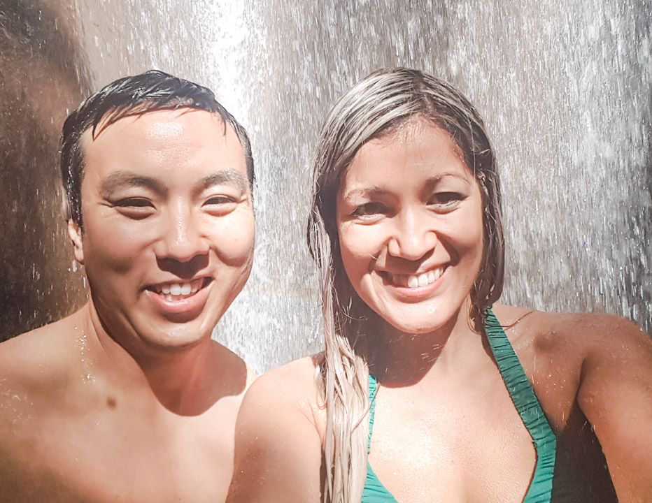
About 5 minutes in, you will reach the magnificent hidden waterfall!
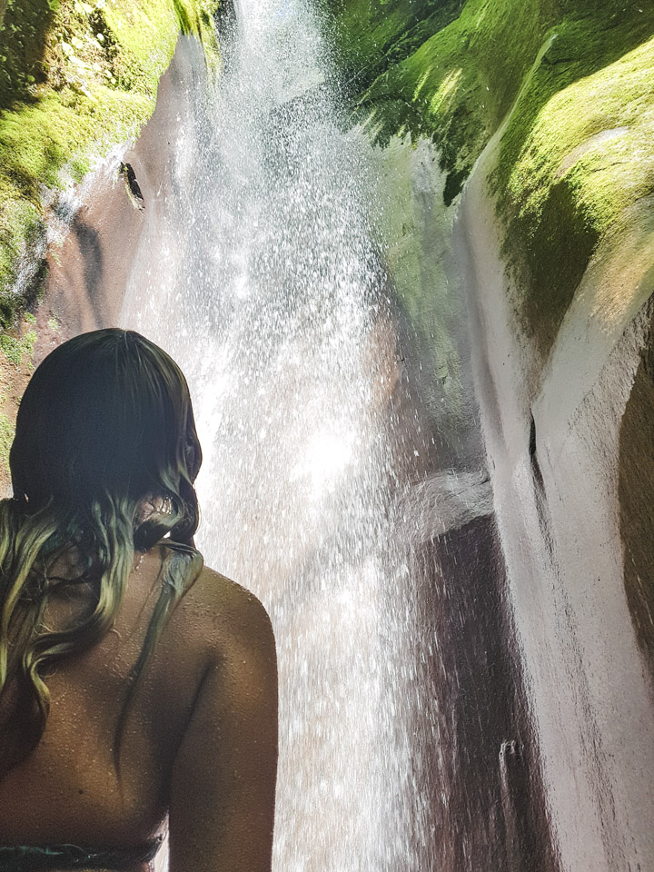
Sombrio Beach Hidden Waterfall Review: Last but not least, Sombrio Beach Hidden Waterfall is my favorite of all the Victoria, BC waterfalls! It is so fun to find this hidden gem. Even in the summer, the waterfall flows strong and it is refreshing to stand beneath it and feel the power of that cold water flow over you.
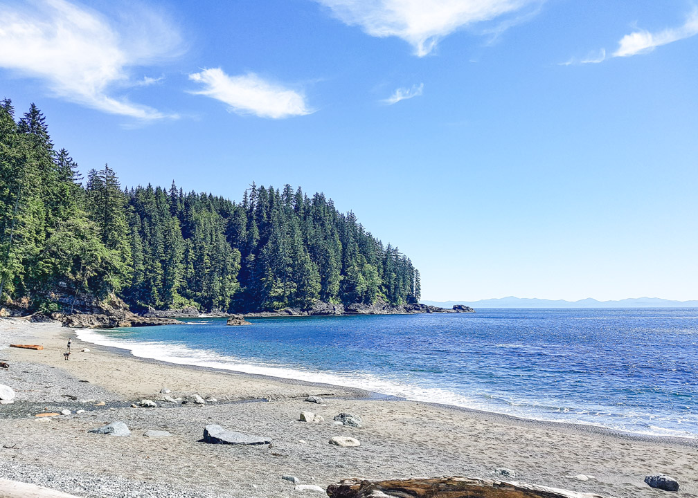
 Afterwards, you can enjoy beautiful Sombrio Beach. If you are up to it, you can even camp right on the beach! It’s one of the best camping spots, if you ask me!
Map of Victoria, BC Waterfalls
Click here to read our full Privacy Policy and Affiliate Disclosure Statement.
More Victoria, BC posts you might like:
A Local’s Guide to Taking the Ferry from Vancouver to Victoria
Driving from Victoria to Tofino: Road Trip Tips from a Local
Visiting Butchart Gardens: The Ultimate Guide
Whale Watching in Victoria, BC
Malahat SkyWalk Visitor’s Guide
Pin this Victoria, BC Waterfalls post!

Gotta love a good waterfall and these are wonderful. I really like the one that falls on the beach. Great detailed directions.
Yes, the waterfalls that flow onto the beach are lovely 🙂 Hope the directions will be useful!
Some really unique waterfalls! I love the ones cascading onto the beach, I’ve never seen that before
Yes, aren’t they cool?!
These look so refreshing! Sadly, there are not that many waterfalls in Southern California. I have checked a bunch in the northern part of the state. Hopefully, we will be able to visit later during the year (things are a bit difficult now).
That’s too bad. At least SoCal has awesome beaches 🙂 Hope you can visit the waterfalls in northern California once it’s safer to do so 🙂
These are awesome! I always love visiting waterfalls, so I will totally try to find some of these next time we visit the Island! I especially love the hidden waterfall. I have never seen one like that before!!
If you come over to Vancouver, I’ll make a list for you over here. (I found soooo many good ones this spring.)
Yes, that hidden waterfall is my favorite! So unique.
Oh, I would appreciate that so much, thank you! Hoping we can go over to Vancouver again later this summer 🙂
Oh wow there are a lot of waterfalls in Victoria. We don’t have many in Perth, just one or 2 closeby. Otherwise far off in north.
Yes, actually most people wouldn’t think there would be that many here 🙂
Well, one or two are still nice to have 🙂
[…] Read more: 11 Victoria, BC Waterfalls You Can’t Miss! […]
So beautiful! I lived in Victoria for a lot of 2019 and despite recognising where lots of these waterfalls are, I never actually visited any of them! Will have to go back again for sure 🙂
Oh, did you?! That’s awesome. That’s too bad you never got to visit any of these! Yes, you’ll have to come back 🙂
Oh wow. These waterfalls look lovely. I had no idea there were so many in the area. Thanks for sharing.
Yes, there are a lot of lovely ones here that people probably wouldn’t expect!
[…] forget to make a quick detour to check out the Niagara Falls waterfall! It is just a few minutes walk up the trail on the […]
[…] 11 Victoria, BC Waterfalls You Can’t Miss […]
Thank you so much for the detailed information on all of these waterfalls! I followed your directions and checked out quite a few of them yesterday and today, but unfortunately I couldn’t find your favorite hidden waterfall at Sombrio Beach. Your directions were as clear as they can be but I believe the cave you were referring to is now blocked by a fallen tree as of today if I found the right one. I couldn’t figure out how to get past it so I couldn’t get to the waterfall any more. I enjoyed the beach but I was really looking forward to the waterfall. If you have a chance to go back, please confirm if I found the wrong place or it is no longer accessible. Thanks!
Hi Sophia,
I’m so happy to hear you found my post useful and were able to check out a number of the waterfalls! So sorry you were unable to find the Sombrio waterfall – I know a lot of people have trouble finding it. I don’t know anything about the fallen tree but perhaps that could be it! I will try to visit again in July and report back. Hopefully it can still be accessed!
[…] 11 Victoria, BC Waterfalls You Can’t Miss […]
This website was… how do you saay it? Relevant!!
Finally I’ve found something that helped me. Appreciate it!